
Construction projects move fast, and missing a problem early can cost tens of thousands of dollars by the time someone catches it from the ground. Aerial construction drone services give project managers, site supervisors, and engineers a bird’s-eye view of every phase without stopping work or putting anyone at risk. These aren’t novelty gadgets. They are professional tools that produce measurable data, legal documentation, and real cost savings.
From foundation surveys to rooftop inspections, drones now handle tasks that once required scaffolding, helicopters, or ground crews working dangerous angles. Understanding what these services cover, what they cost, and what regulations apply helps you choose the right provider and get the most out of every flight.
Key Takeaways
- Drones reduce inspection time by up to 80% compared to traditional methods on large construction sites.
- FAA Part 107 certification is required for any commercial drone operation, including construction work.
- Common deliverables include orthomosaic maps, 3D models, thermal reports, and progress photos.
- Costs vary by service type, with basic aerial photography starting around $300 and full photogrammetry surveys ranging from $1,500 to $5,000 per visit.
- Liability and airspace authorization are your provider’s responsibility, not yours, when you hire a compliant operator.
What Do Aerial Construction Drone Services Actually Include?
Quick Answer: Aerial construction drone services include site surveys, progress photography, 3D terrain mapping, thermal inspections, stockpile volume measurements, and safety monitoring. Each service produces specific deliverables like maps, models, or reports for project teams.
The term covers a wide range of professional tasks. A site survey captures precise measurements before breaking ground. Progress photography documents milestones for clients and lenders. Thermal imaging finds moisture intrusion, insulation gaps, or electrical hot spots in roofing and wall assemblies. Photogrammetry, which is the process of creating 3D models from overlapping photos, turns raw drone footage into accurate digital terrain models and volume calculations.
Stockpile measurement is one of the most financially valuable applications. Instead of sending someone to climb a gravel pile with a measuring tape, a drone flight produces a precise cubic-yard calculation in under an hour. Safety monitoring uses live or recorded footage to track worker positions and identify hazard zones during active construction phases.
What Equipment Do Professional Construction Drone Crews Use?
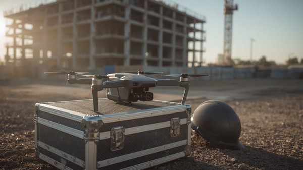
Quick Answer: Professional crews use multirotor drones like the DJI Matrice 350 RTK for precision mapping, fixed-wing drones for large acreage surveys, and thermal sensors like FLIR for infrared inspections. RTK GPS delivers centimeter-level accuracy.
| Drone Model | Primary Use | Sensor Type | Positional Accuracy | Typical Flight Time |
|---|---|---|---|---|
| DJI Matrice 350 RTK | Mapping and inspection | RGB, LiDAR, thermal | 1 cm horizontal | 55 minutes |
| DJI Phantom 4 RTK | Site surveys | RGB with RTK GPS | 1.5 cm horizontal | 30 minutes |
| senseFly eBee X | Large acreage mapping | RGB, multispectral | 3 cm with GCPs | 90 minutes |
| Skydio 2+ | Autonomous inspection | RGB with obstacle avoidance | 5 cm relative | 27 minutes |
What FAA Rules Apply to Construction Drone Flights?
Quick Answer: All commercial drone flights in the U.S. require FAA Part 107 certification for the pilot. Flights near airports need LAANC authorization. Operations over people or at night require waivers. Violations carry fines up to $32,666 per incident.
When you hire faa certified drone services for your construction project, the provider handles airspace authorizations, site risk assessments, and compliance documentation. That protects you legally if an incident occurs. Always ask for a copy of the pilot’s Part 107 certificate and proof of liability insurance before work begins.
Restricted airspace is common near urban construction zones. LAANC, which stands for Low Altitude Authorization and Notification Capability, is the FAA’s digital system for near-real-time airspace approval. A qualified provider will clear this before arriving on site, not after.
How Much Do Aerial Construction Drone Services Cost?
Quick Answer: Basic aerial photography costs $300 to $800 per visit. Full photogrammetry surveys run $1,500 to $5,000. Thermal inspections average $1,000 to $3,500. Ongoing monthly progress documentation packages typically range from $800 to $2,500 per month.
Pricing depends on site size, deliverable complexity, travel distance, and turnaround time. A single-day roof inspection with a thermal report costs far less than a full topographic survey with a processed 3D point cloud. Rush processing, same-day delivery, or flights requiring special waivers add to the base rate.
What Deliverables Should You Expect?
A professional provider hands over more than raw footage. Expect orthomosaic maps in GeoTIFF format, 3D mesh models compatible with platforms like Autodesk BIM 360, annotated progress reports, and georeferenced data sets. Make sure deliverable formats match your project management software before signing a contract.
How Do You Choose the Right Aerial Construction Drone Provider?
Quick Answer: Choose a provider with FAA Part 107 certification, at least $1 million in liability insurance, verifiable construction-sector experience, and the ability to deliver georeferenced data in your required formats. Check references from past general contractors.
Hiring certified drone pilot services means more than checking a license. Ask how many construction projects the crew has completed, what software they use for processing, and how quickly they deliver final files. A provider with construction-specific experience understands site safety protocols, can coordinate with your superintendent, and knows how to handle active job site conditions.
Construction sites carry unique risks: moving equipment, restricted zones, and variable airspace. A provider without job site experience may technically hold a license but lack the judgment to operate safely around a crane swing or active concrete pour.
What Is the ROI of Using Drones on a Construction Project?
Quick Answer: Studies from firms like McKinsey show drone-enabled construction monitoring reduces rework costs by 20 to 25%. Early detection of grade errors, drainage issues, or structural deviations pays back the cost of drone services many times over on mid-size and large projects.
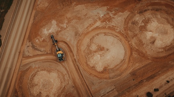
Volume measurement alone justifies the cost on earthworks projects. Manual stockpile surveys can take a full day per site. A drone covers the same area in under an hour with greater accuracy. That time savings compounds across a multi-month project schedule.
Frequently Asked Questions
Do I need to notify anyone before a drone flies over my construction site?
Your drone provider handles all required notifications, including LAANC authorization and any local permits. You should inform your site superintendent and subcontractors in advance so crew members are aware of overhead operations during the flight window.
Can drones work on active construction sites with equipment running?
Yes, experienced crews coordinate flights around active equipment using pre-planned flight paths and communication with site supervisors. Most inspections can be completed during normal working hours without halting operations.
How accurate are drone-generated topographic surveys?
RTK-equipped drones achieve horizontal accuracy of 1 to 2 centimeters and vertical accuracy of 2 to 3 centimeters when ground control points are used. This meets the accuracy standards required for most construction grading and earthwork applications.
What is the typical turnaround time for processed drone data?
Standard turnaround for orthomosaic maps and 3D models is 24 to 72 hours after the flight. Rush processing options are available from most providers for an additional fee, often delivering results within 12 hours.